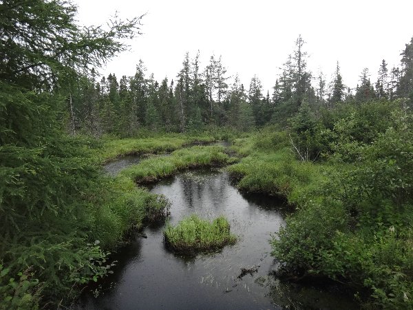
17 miles / 27km Pine Stream, Penobscot River - Boy Scout, Chamberlain lake
Stormy
27 km today of which 15 km PORTAGED
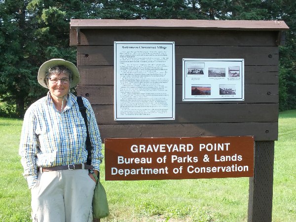
We are still debating this morning Allagash Lake or Mud Portage. We have plenty of time so the Allagash Lake route is favourite. However we would like to know whether there is actually some water in the Allagash stream. On one of our maps, a Ranger Station is marked just south of Chesuncook village. We plan to visit the Ranger station at Chesuncook and hope that they have some information about water levels in the Allagash stream. We set off with a cloudless sky and a short time later we beach at Graveyard Point.
|
|
|
A walk thru Chesuncook village reveals that both the hotel and store (we have been looking forward to a drink of root beer) are CLOSED.
|
|
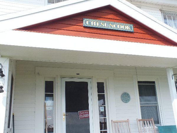 |
We walk down the road in a southerly direction past some unoccupied houses in search of a ranger station. I bump into one of the few residents who is out walking her dogs. She confirms that there is NO ranger station here. Further she tells me that the man who sold root beer in previous years is very ill and has decided to stop selling root beer this year. She tells me that the owners of the hotel have 3 businesses and sometimes the hotel is open and sometimes it is closed. In addition to all this information, she warns us to be careful today because she has just heard a weather warning for Maine and that is why she is out walking her dogs earlier than her normal routine. According to the forecast, winds, thunder, hail and storms are predicted. As she tells me this, we observe that the sky is no longer clear and storm clouds are forming. She is so apologetic that she cannot give us any information about water levels in the Allagash stream! We walk back to the boat and decide that since we have no information about water levels on the Allagash stream, we will opt for the Mud Portage carry.
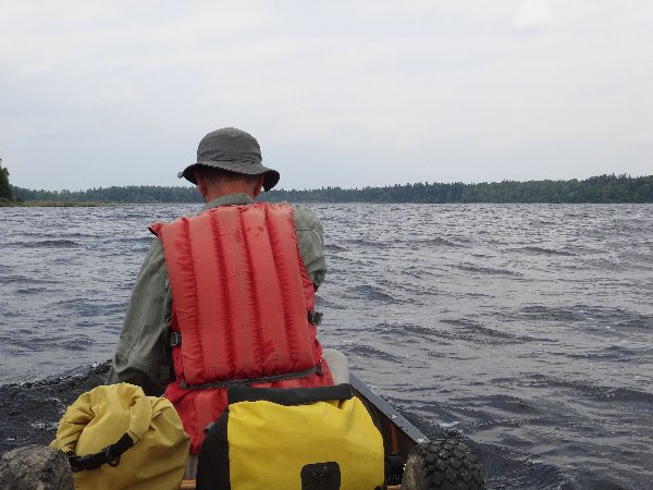
Since we landed at Graveyard Point, the wind has indeed picked up from the NW and we gingerly paddle from headland to headland. As we pass the campsite Longley Stream we meet up again with our neighbours from two nights ago at Lobster Lake. They are camped here for 2 nights and tomorrow will pick up their vehicle which is parked at the North Maine Woods site. We stop for a short chat and then press on as the skies are getting darker and the waves higher.
|
|
 |
We are literally blown down to Longley Stream Bridge in no time and as we land the rain and thunder commence. We now have a dilemma. The nearest camping sites on Umbazooksus Stream are full and to get to the site on the opposite side of the lake would mean fighting a loosing battle with the wind. We want to start the Mud Pond carry tomorrow because the thru-paddlers guide suggests you need a whole day to do it and it is now already gone 1pm. Maybe we should camp at the start of the carry but the prospect of spending a stormy afternoon together with clouds of insects which are around does not appeal. Our eyes look towards the road. It looks flat as far as you can see and studying the map reveals there are hardly any contour lines crossing the road. We calculate that if we were to walk along Longley Stream Road, based on our experience and progress on the Hardscrabble road portage, it will take till 6 or 7 pm to portage along the road.
To the rumble of thunder and wearing waterproofs we set off. After about a third of the distance done we are beginning to regret our decision. We are both soaked in sweat and the rain is continuous. My knee injury from last year (nearly recovered before the trip) is starting to feel painful. We continue in ½ hour stages.
We thought before starting maybe we could put in at Dottle Brook but that is too small.
|
Dottle Brook |
Dottle Brook |
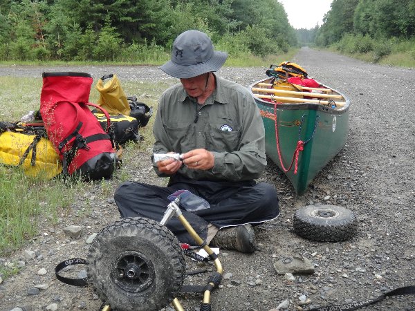
The wheel bearings get hot and need regreasing.
|
|
 |
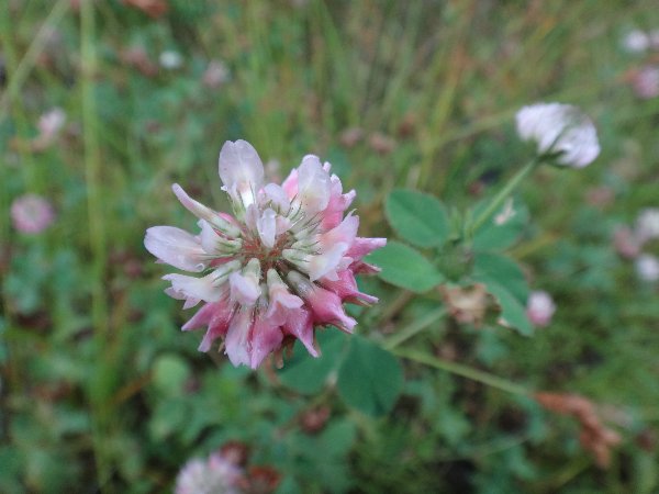
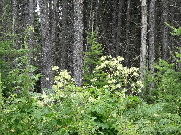
Wild flowers growing alongside the road always look prettier in the rain.
|
|
 |
|
|
 |
Job done around 6.15pm
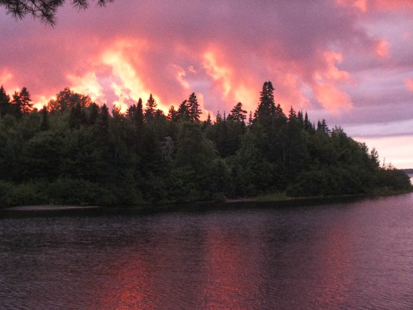
We call in at the Ranger Station at Chamberlain bridge. The ranger is busy helping a guy with his motorboat and asks us to wait. It is nice to sit in a chair for 20 minutes until the ranger comes along to the office. He thinks we are completely bonkers to have portaged along the road. He tells us that all the (scout) groups enter the Allagash system via the Mud Carry. We purchase an Allagash Waterway Permit for 7 nights and the ranger has difficulty calculating the costs. It is apparently the first time that he has done a cash transaction for a permit. Normally people pay at a check point entering the system by car. We set off for the nearest campsite. Boy Scout (the same name as at Lobster Lake) is free but this time WITHOUT mosquitoes. We quickly pitch the tent, cook the one instant reserve meal we have with us (just add boiling water) and soon retire to bed for a long nights sleep after first admiring the incredible sunset.
PS1
It is day 40 on the trail and it is 40 years to the day since we started living together. What a way to celebrate - our longest portage ever in all our years of canoe tripping and in the rain to boot.
PS2
This evening after the storm we were rewarded with one of the most beautiful sunsets we have ever seen. The configuration of clouds and trees make it look like a real forest fire.
|
|
 |
| Next |